
![]()
The Royal Belgian Institute for Natural Sciences (RBINS) is a Belgian Federal Government Scientific Establishment. The RBINS Remote Sensing and Ecosystem Modelling (REMSEM) is carrying out scientfic research and analysis in the field of marine ecosystems to improve the long term scientific basis for management of the marine ecosystems.
The team has 20 years’ experience in the development of algorithms for the processing of ocean colour data (including atmospheric correction) and in the validation and exploitation of satellite-derived products with particular expertise in turbid coastal waters.
RBINS has been making measurements of Ocean Colour radiometry since 2001 using a three-sensor abovewater TRIOS system and was a de facto leader of this methodology, termed “MUMM_TRIOS”, within the MERISValidation Team.
General Ocean Colour experience
The RBINS REMSEM team has 20 years’ experience in the development of algorithms for the processing of ocean colour data (including atmospheric correction) and in the validation and exploitation of satellite-derived products with particular expertise in turbid coastal waters.
RBINS’ experience goes back to the beginning of the SeaWiFS mission, where RBINS developed and distributed in 2000 an extension to the SeaDAS atmospheric correction algorithm for turbid waters, the first such publicly-available algorithm functioning for turbid waters. In 2001 RBINS joined the MERIS Validation Team (MVT) at its inception and has participated actively in all MVT activities since then until the demise of Envisat and is a key member of the Sentinel-3 Validation Team (S3VT). RBINS also participates actively in the MERIS and PROBA-V Quality Working Groups.
RBINS has experience of processing optical data over water from a wide range of satellite missions including: MERIS, SeaWiFS, MODIS-AQUA, MODIS-TERRA, Landsat-8, SPOT, SEVIRI, AVHRR, Pléiades, PROBA-V, Sentinel-2, etc. and plans to process in the near future also: Sentinel-3/OLCI and SLSTR, VIIRS, MTG, etc.
RBINS has authored a large number of scientific publications; A limited few are presented here to demonstrate, in particular, experience with the need for validation of ocean colour data (atmospheric correction). Experience with making measurements is demonstrated in a later section.
References on development of atmospheric correction algorithms for ocean colour data
- Vanhellemont Q. & Ruddick K. Advantages of high quality SWIR bands for ocean colour processing: Examples from Landsat-8 (2015) Remote Sensing of Environment, Vol. 161 pp. 89–106.
- Ruddick K. & Vanhellemont Q. Use of the new OLCI and SLSTR bands for atmospheric correction over turbid coastal and inland waters (2015) Submitted for the proceedings of the Sentinel-3 for Science Workshop held in Venice-Lido, Italy, 2-5 June 2015, ESA Special Publication SP-734. Available from http://odnature.naturalsciences.be/remsem/publications
- Vanhellemont Q. & Bailey S. & Franz B. & Shea D. Atmospheric Correction of Landsat-8 Imagery Using SeaDAS (2014) Submitted for the proceedings of the Sentinel-2 for Science Workshop held in Frascati, Italy, 20-23 May 2014, ESA Special Publication SP-726. Available from http://odnature.naturalsciences.be/remsem/publications
- Vanhellemont Q. & Ruddick K. (2014). Turbid wakes associated with offshore wind turbines observed with Landsat 8. Remote Sensing of Environment, Vol. 145, pp. 105–115.
- Ruddick K. & Neukermans G. & Vanhellemont Q. & Jolivet D. Challenges and opportunities for geostationary ocean colour remote sensing of regional seas: a review of recent results (2014) Remote Sensing of the Environment, Vol. 146 p. 63-76.
- Goyens C., Jamet C. & Ruddick K. (2013). Spectral relationships for atmospheric correction. II. Improving NASA’s standard and MUMM near infra-red modeling schemes. Optics Express, Vol. 21(18), pp. 21176–21187. DOI: 10.1364/OE.21.021176.
- Dogliotti A.-I., Ruddick K., Nechad B. & Lasta C. (2011). Improving water reflectance retrieval from MODIS imagery in the highly turbid waters of La Plata River.
- Sterckx S., Knaeps E. & Ruddick K. (2011). Detection and correction of adjacency effects in hyperspectral airborne data of coastal and inland waters: the use of the near infrared similarity spectrum. International Journal of Remote Sensing, Vol. 32, pp. 21–6479-6505. DOI: 10.1080/01431161.2010.512930.
- Neukermans G., Ruddick K., Bernard E., Ramon D., Nechad B. & Deschamps P.-Y. (2009). Mapping total suspended matter from geostationary satellites: a feasibility study with SEVIRI in the Southern North Sea. Optics Express, Vol. 17(16), pp. 14029–14052.
- Ruddick K., Ovidio F. & Rijkeboer M. (2000). Atmospheric correction of SeaWiFS imagery for turbid coastal and inland waters. Applied Optics, Vol. 39(6), pp. 897–912.
RBINS is coordinating the FP7/HIGHROC project (www.highroc.eu) with objectives to develop new waterproducts and services from MSG/SEVIRI and Landsat-8 and Sentinel-2 for coastal water applications. HIGHROC includes a significant validation component:
- Ruddick K. & Brockmann C. & De Keukelaere L. & Doxaran D. & Knaeps E. & Forster R. & Jaccard P. & Lebreton C. & Ledang A.-B. & Nechad B. & Norli M. & Sorensen K. & Stelzer K. & Vanhellemont Q. & Van der Zande D. Processing and exploitation of Sentinel-2 data for coastal water applications: The HIGHROC Project (2014) Submitted for the proceedings of the Sentinel-2 for Science Workshop held in Frascati, Italy, 20-23 May 2014, ESA Special Publication SP-726. Available from http://odnature.naturalsciences.be/remsem/publications
Specific experience of Ocean Colour radiometry
RBINS has been making measurements of Ocean Colour radiometry since 2001 using a three-sensor abovewater TRIOS system and was a de facto leader of this methodology, termed “MUMM_TRIOS”, within the MERIS Validation Team. The measurement protocol designed in detailed by RBINS (but based largely on the NASA Ocean Optics Protocols) was documented by RBINS in 2003 in pp 40-43 the REVAMP protocols (Tilstone et al, 2003) and, with a detailed uncertainty analysis in (Ruddick et al, 2006), and has been adopted, with some local variants, by various teams in Europe and worldwide, especially within the MERIS and Sentinel-3, Validation teams. RBINS has held a pioneering role internationally in the exploitation and validation of near infrared marine reflectance data in turbid waters.
RBINS is running two AERONET-OC sites in Belgian waters, in coastal waters close to Zeebrugge (since 2014) and further offshore in clearer waters on the Thornton Bank (since 2015), providing a continuous source of ocean colour validation data for present and future optical remote sensors including Sentinel-3/OLCI (but also MODIS-AQUA, MODIS-TERRA, Landsat-8, MSG/SEVIRI, Pléiades, PROBA-V, Sentinel-2, SLSTR visual bands,VIIRS, MTG, …!):
• Ruddick K. & Van der Zande D. & Vanhellemont Q. Multi-sensor ocean colour validation in Belgian waters (2014) Proceedings of the Ocean Optics XXII conference held in Portland, USA, 26-31 October 2014. Available from http://odnature.naturalsciences.be/remsem/publications
RBINS has attended regularly and participated in MERIS Validation Team and, since the demise of ENVISAT, Sentinel- 3 Validation Team meetings and has participation in numerous formal in situ measurement protocol intercomparisons for radiometry (Plymcal-1, GKSS-2012, AAOT-2010, AAOT-2014) as well as informal interomparisons of ocean colour radiometry (RV Alliance/2010, SEASWIR/BuenosAires2012, TURBINET/BuenosAires2014, many cruises of RV Belgica with international participants).
RBINS supplied the “MUMM_TRIOS” dataset to the MERMAID database.
RBINS has studied the impact of platforms on abovewater radiometric measurements using high spatial resolution imagery from Landsat-8 and Pléiades to quantify small-scale spatial variability of the water in the vicinity on the platform (both natural and platform-induced) and contamination of pixels at top of atmosphere caused by reflectivity of the platform itself (Vanhellemont and Ruddick, 2015; Dogliotti et al, 2015):
- Vanhellemont Q. & Ruddick K. Assessment of Sentinel-3/OLCI sub-pixel variability and platform impact using Landsat-8/OLI (2015) Submitted for the proceedings of the Sentinel-3 for Science Workshop held in Venice-Lido, Italy, 2-5 June 2015, ESA Special Publication SP-734. Available from http://odnature.naturalsciences.be/remsem/publications
- Dogliotti A.-I. & Gossn J.I. & Vanhellemont Q. & Ruddick K. Evaluation of two sites for ocean color validation in the turbid waters of the Rio de la Plata (Argentina) (2015) Submitted for the proceedings of the Sentinel-3 for Science Workshop held in Venice-Lido, Italy, 2-5 June 2015, ESA Special Publication SP-734. Available from http://odnature.naturalsciences.be/remsem/publications
Key RBINS co-authored references on in situ measurement protocols used for ocean colour validation
- Zibordi G., Ruddick K., Ansko I., Moore G., Kratzer S., Icely J. & Reinart A. (2012). In situ determination of the remote sensing reflectance. Ocean Science, Vol. 8, p. 567-586.
- Ruddick K., De Cauwer V., Park Y. & Moore G. (2006). Seaborne measurements of near infrared water-leaving reflectance: The similarity spectrum for turbid waters. Limnology and Oceanography, Vol. 51(2), pp. 1167–1179.
- Tilstone G., Moore G., Sorensen K., Doerffer R., Rottgers R., Ruddick K., Pasterkamp R. & Jorgensen P. (2003). REVAMP Regional Validation of MERIS Chlorophyll products in North Sea coastal waters: Protocols document. In: Proceedings of MERIS and AATSR Calibration and Geophysical Validation (MAVT-2003), ESA Special Publication WPP-233.
Other references including use of OCR for the Validation of Marine reflectance
- Sterckx S. & Knaeps E. & Kratzer S. & Ruddick K. SIMilarity Environment Correction (SIMEC) applied to MERIS data over inland and coastal waters (2015) Remote Sensing of Environment, Vol. 157 pp. 96–110.
- Goyens C., Jamet C. & Ruddick K. (2013). Spectral relationships for atmospheric correction. I. Validation of red and near infra-red marine reflectance relationships. Optics Express, Vol. 21(8), pp. 21162–21175. DOI: 10.1364/OE.21.021162.
- Jamet C., Loisel H., Kuchinke C., Ruddick K., Zibordi G. & Feng H. (2011). Comparison of three SeaWiFS atmospheric correction algorithms for turbid waters using AERONET-OC measurements. Remote Sensing of Environment, Vol. 115, pp. 1955–1965. DOI: 10.1016/j.rse.2011.03.018.
- Ruddick K., Park Y., Astoreca R., Neukermans G. & Van Mol B. (2008). Validation of MERIS water products in the Southern North Sea: 2002-2008. In: Proceedings of the 2nd MERIS-(A)ATSR workshop, ESA Special Publication SP-666.
- Park Y., Van Mol B. & Ruddick K. (2006). Validation of MERIS water products for Belgian coastal waters: 2002-2005. In: Proceedings of the Second Working Meeting on MERIS and AATSR Calibration and Geophysical Validation (MAVT-2006). SP-615
- Ruddick K. et al (2003). Preliminary validation of MERIS water products for Belgian coastal waters. In: Envisat Validation workshop, 9-13th Dec 2002. European Space Agency.
- Park Y., De Cauwer V., Nechad B. & Ruddick K. (2003). Validation of MERIS water products for Belgian coastal waters: 2002-2003. In: MERIS and AATSR Calibration and Geophysical Validation workshop. European Space Agency WPP223
RBINS is connected to international OCR validation community by
- MERIS Validation Team (2001-2014),
- Sentinel-3 Validation Team (2013-future),
- AERONET-OC network (2014-future)
hosting many international teams on cruises of the Research Vessel Belgica, including OCR teams from LOV, NIVA and JRC in 2015; participation in various ad hoc protocol intercomparison exercise (AAOT-2010, AAOT-2014); participation in various protocol-oriented workshops, e.g. NASA AOP workshop 2010, “In situ measurement protocol revision for cal/val“ splinter session of IOCS meeting 2013, etc., regular informal discussions with JRC and calibration visits to JRC, TURBINET project, including radiometric intercomparison with IAFE team (Argentina). RBINS is also preparing a hyperspectral parallel to the AERONET_OC network, called “HYPERNET-OC” (S3VT proposal 2013).
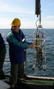 PhD. Kevin Ruddick has participated in about 40 cruises and field campaigns, about one third of which as Chief Scientist, totalling about 200 field work days using above water radiometry, with a large number of other teams, and from a large diversity of platforms, both fixed (AAOT*2, Sint Anna pontoon*2, Buenos Aires Fishermans Pier*2, Pauillac quay, Blaye pontoon) and ship-based (RV Belgica*~30, RV Squilla, RV Alliance, Tuimelaar RIB, etc.). Role in the project: WP100 Project manager of RBINS, WP 200 manager, WP400 scientist.
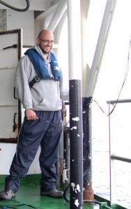
 Bouchra Nechad has participated in about 10 cruises and field campaigns, totalling about 40 field work days using abovewater radiometry, with a large number of other teams, and from a large diversity of platforms, both fixed (Sint Anna pontoon*2, Pauillac quay, Blaye pontoon, 3*Belgian inland waters) and ship-based (RV Belgica*~8). Role in the project: scientist of WP200/300/400.
 Dimitry Vanderzande has designed and installed the local implementation of two AERONET-OC sites and is responsible for the day-to-day running of these sites. He also has experience in operating spectroradiometers for laboratory experiments. Role in the project: scientist of WP200.