ACRI-ST is a member of the ACRI Group established in 1989, comprising companies that provide services the scope of which spans from satellite remote sensing, ocean & land surveys to hydraulic civil engineering through environmental research Computational Fluid Dynamics and dynamic similitude. The ACRI group consists of a hundred people spread across all office sites (Figure 1, 2).
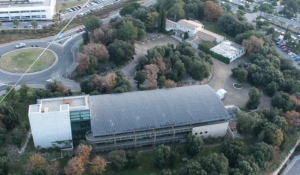
Fig 1. ACRI head office in Sophia Antipolis, France
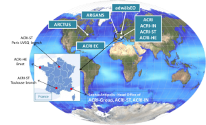
Fig 2. ACRI group offices distribution
ACRI-ST is a supplier to space agencies (simulation of space-based sensors; operational chains development; processing, archiving and mission performance centres) and develops/operates environmental Copernicus services to end users (Figure 3).
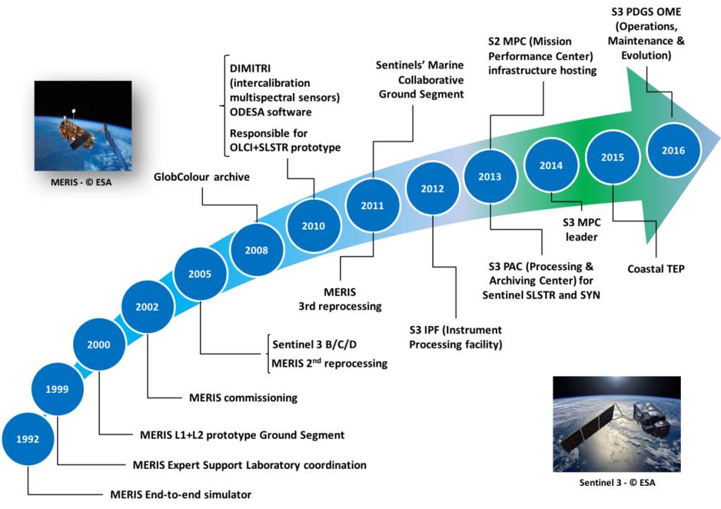
Fig 3. History in Earth Observation
In the group, ACRI-ST specializes in (Figure 4)
- Earth Observation (EO) mission specifications and End-to-End simulations; design of sensing equations, algorithm and data processor development; operation of components of EO mission Ground Segments;
- Environmental monitoring – the so-called EO Mission user segments;
- ITC research and data services for EO missions’ ground segments and environmental engineering.
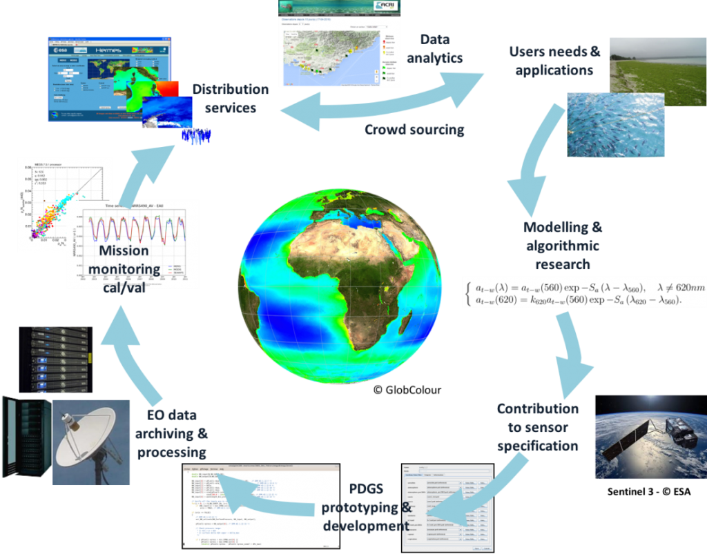
Fig 4. ACRI-ST EO expertise
ACRI-ST has more than twenty-five years of experience in Cal/Val for Earth Observations missions. They built up their expertise particularly on MERIS/ENVISAT. They have further confirmed this expertise and ACRI is now a key expert in the frame of Sentinel-2 and Sentinel-3 mission performance centres.
Of particular relevance to FRM4SOC, ACRI-ST brings its experience in several domains:
- Earth Observation Satellite Sensors Cal/Val Activities
MERIS calibration,OLCI calibration,SeaWiFs and MODIS calibration,
Sentinel 2 radiometry calibration, Sentinel 2 & Sentinel 3 Mission Performance Centre
- Validation with In situ Data and Vicarious Calibration (Figure 5, MERMAID, SeaSideRendezVous)
- Ocean Colour Expertise, Knowledge Fostering, Training (GIS COOC,OSS2015,GlobColour)
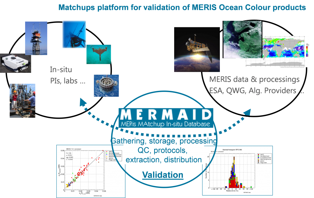
Fig 5. MERMAID CalVal facility
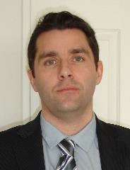 Dr. Christophe Lerebourg was awarded a PhD in marine optics from the University of Plymouth (UK). He then worked for two years at the Federal University of Rio Grande (Brazil) on in situ radiometric measurements and EO data processing in the context of ocean colour and SST studies. He joined ACRI-ST in 2006 to work on various projects requiring a strong expertise in ocean sciences, optical remote sensing and bio-optics.
As examples of his activities, we can cite:
• Vicarious calibration for MERIS 3rd and 4th data reprocessing (algorithm development and operational implementation);
• MERIS and Sentinel-3 Cal/Val activities;
• MERMAID facility specification and development;
• ODESA processing platform development and organisation of training for the OC users community;
• Organisation and animation of ocean colour workshops as president of the GIS COOC executive committee;
• In situ data collection and quality control to populate MERMAID matchup database;
• Algorithm development and data validation in the GlobColour project.
As part of the MERIS maintenance activities, he has been very much involved in the development of the MERIS vicarious adjustment procedure. In the continuity of the MERIS mission, he is currently involved in the Sentinel-3 Mission Performance Centre for the specification, development and exploitation of multi-sensors Cal/Val tools for Sentinel-3. In particular, he has extended the MERMAID facility for OLCI validation activities. His expertise in MERIS vicarious calibration is of prime interest for the development of the OLCI vicarious calibration procedures.
In addition, he has also been involved in various OC projects for CNES, such as the development of the Kalicôtier platform, the development and the assessment of new generation OC algorithms, in-flight calibration of OC sensors. He is also very much involved in the definition of the Geo-OCAPI mission. He is president of the GIS-COOC Executive Committee (French scientific group on Ocean Colour).
Role in the project: WP500 manager.

